The majority of the text in this subsection is taken directly from the Surficial Geologic Map of the Lewiston Orchards North Quadrangle and Part of the Clarkston Quadrangle, Nez Perce County, Idaho (Othberg et al. 2003). The surficial deposits in the watershed are categorized into five separate units. Figure 3 provides a general representation of the surficial geology of the watershed.
- Unit 1: Loess (Holocene and Pleistocene) Loess soil extends to the upper plateau of the Lindsay Creek watershed and eastern sections of the Lewiston Orchards, occupying approximately 72% of the watershed. The soil is composed of calcareous wind-blown silt, sandy near deposits of the Lake Missoula Floods. Composition partly correlates with the Palouse Formation; however, it lacks the distinctive Palouse Hills of the eastern Columbia group, and is composed of a single late Pleistocene deposit. Exposures show one to several layers that represent periods of rapid depositions of air-borne dust. The thickest layers of loess material may have formed immediately after the Lake Missoula Floods backwater events in the Clearwater and Snake River valleys. Soil thickness is 5 to 20 feet and may be greater than that on some north-facing slopes where it is thickened by wind drift and where vegetation prevents erosion.
- Unit 2: Alluvium of Side Streams (Holocene) This unit is composed of channel and flood-plain deposits of tributaries to the Clearwater River. It consists primarily of coarse gravels deposited during high-energy stream flows, with subrounded to rounded boulders, cobbles, and pebbles of basalt in a sand matrix. It includes intercalated colluvium and debris-flow deposits from steep side slopes. Soils developed inside-stream alluvium include the Bridgewater and Lapwai soil series.
- Unit 3: Colluvium from Basalt (Holocene and Pleistocene) These areas contain primarily poorly sorted brown muddy gravel composed of angular and subangular boulders, cobbles, and pebbles of basalt in a matrix of silt and clay. Deposits have been emplaced by gravity movements on steep-sided canyons and gullies cut into Columbia River basalt. Steep, dry, southerly aspects commonly contain outcrops of basalt where colluvium is thinner and the more erosion-resistant basalt flows from laterally traceable edges. More gently sloping areas are covered with thin loess, typically 1-5 feet thick, particularly close to boundaries with loess units.
- Unit 4: Alluvium and Colluvium (Holocene) Areas within this unit consist ofstream, slope-wash, and gravity deposits. Predominately beds of silt, clay, and sand received through the erosion of bordering depositional units. Stream deposits are characteristically thin and interfinger with laterally thickening deposits of slope wash and colluvium derived from local loess deposits and weathered basalt. Soils developed in these deposits include the Broadax and Slickpoo series.
- Unit 5: Landslide Deposits (Holocene and Pleistocene) This unit contains poorly sorted and poorly stratified angular basalt cobbles and boulders with silt and clay. Landslide deposits include debris slides as well as blocks of basalt, sedimentary interbeds that have been rotated and moved laterally. Debris slides mainly composed of unstratified, unsorted gravel rubble in a clayey matrix.
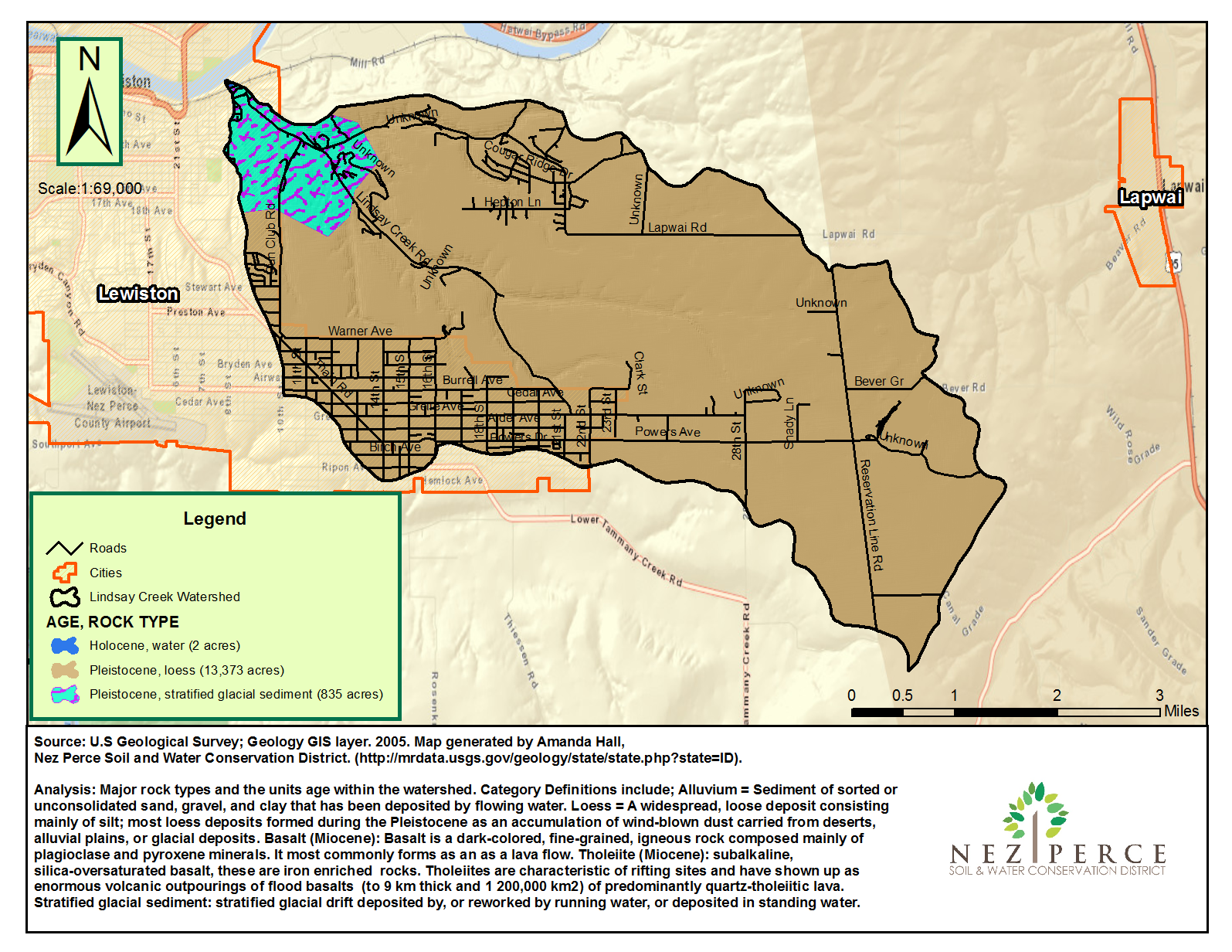
Figure 1. Lindsay Creek geology